NOAA Weather Radio Station

WNG736 162.450 Washington, DC

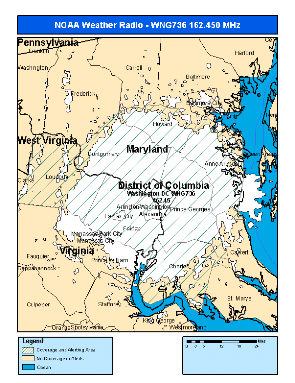
This radio station is licensed by the FCC to The National Weather Service for Washington, DC and serving the following areas:


Anne Arundel County, MD Charles County, MD Howard County, MD Montgomery County, MD Prince Georges County, MD Arlington County, VA Fairfax County, VA Loudoun County, VA District of Columbia County, DC

We are not aware of any currently available online broadcast streams for this station.
Antenna Location: LAT: 38.9629919 ~ LON: -77.0266700
Loading Main Map for ...
NOAA Weather Radio WNG736 S.A.M.E. Code(s):
S.A.M.E.CountyState
024003Anne ArundelMD
024017CharlesMD
024027HowardMD
024031MontgomeryMD
024033Prince GeorgesMD
051013ArlingtonVA
051059FairfaxVA
051107LoudounVA
011001District of ColumbiaDC
WNG736 Coverage Map
Service Frequency Power Latitide Longitude
NOAA Weather RadioWeather162.450 MHz300 W Watts38.9629919-77.0266700

[ Top of Page ]

"WNG736 (162.450) Washington, DC - NOAA Weather Radio"

Radio Station:

Email: support@ | facebook | twitter
Copyright © 2025 Radio Station Info All Rights Reserved.
Station Image
Status
0:00
10
7
5
31Hz
62Hz
125kHz
250kHz
500kHz
1kHz
2kHz
4kHz
8kHz
15kHz
VOL.