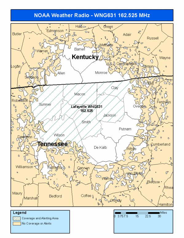
NOAA Weather Radio Station

WNG631 162.525 Lafayette, TN

This radio station is licensed by the FCC to The National Weather Service for Lafayette, TN and serving the following areas:


Allen County, KY Monroe County, KY Clay County, TN Jackson County, TN Macon County, TN Monroe County, TN Smith County, TN Sumner County, TN Trousdale County, TN Wilson County, TN

We are not aware of any currently available online broadcast streams for this station.
Antenna Location: LAT: 36.4321207 ~ LON: -85.8835441
Loading Main Map for ...
NOAA Weather Radio WNG631 S.A.M.E. Code(s):
S.A.M.E.CountyState
021003AllenKY
021171MonroeKY
047027ClayTN
047087JacksonTN
047111MaconTN
047123MonroeTN
047159SmithTN
047165SumnerTN
047169TrousdaleTN
047189WilsonTN
WNG631 Coverage Map
Service Frequency Power Latitide Longitude
NOAA Weather RadioWeather162.525 MHz1000 Watts36.4321207-85.8835441

[ Top of Page ]

"WNG631 (162.525) Lafayette, TN - NOAA Weather Radio"

Radio Station:

Email: support@ | facebook | twitter
Copyright © 2025 Radio Station Info All Rights Reserved.
Station Image
Status
0:00
10
7
5
31Hz
62Hz
125kHz
250kHz
500kHz
1kHz
2kHz
4kHz
8kHz
15kHz
VOL.