NOAA Weather Radio Station

KIH27 162.550 Tulsa, OK

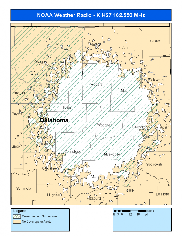
This radio station is licensed by the FCC to The National Weather Service for Tulsa, OK and serving the following areas:


Cherokee County, OK Creek County, OK Mayes County, OK Muskogee County, OK Okmulgee County, OK Osage County, OK Pawnee County, OK Rogers County, OK Tulsa County, OK Wagoner County, OK Washington County, OK


KIH27 can be heard online using the Radio Station Net Player.
Stream Status
Verifying KIH27 Audio Stream ...
Antenna Location: LAT: 36.0207806 ~ LON: -95.6581038
Loading Main Map for ...
NOAA Weather Radio KIH27 S.A.M.E. Code(s):
S.A.M.E.CountyState
040021CherokeeOK
040037CreekOK
040097MayesOK
040101MuskogeeOK
040111OkmulgeeOK
040113OsageOK
040117PawneeOK
040131RogersOK
040143TulsaOK
040145WagonerOK
040147WashingtonOK
KIH27 Coverage Map
Service Frequency Power Latitide Longitude
NOAA Weather RadioWeather162.550 MHz500 Watts36.0207806-95.6581038

[ Top of Page ]

"KIH27 (162.550) Tulsa, OK - NOAA Weather Radio"

Radio Station:

Email: support@ | facebook | twitter
Policies: Terms & Conditions (EULA) | Privacy Policy | Cookies | DMCA

Copyright © 2025 Radio Station Network (RSN)

Station Image
Status
0:00
10
7
5
31Hz
62Hz
125kHz
250kHz
500kHz
1kHz
2kHz
4kHz
8kHz
15kHz
VOL.