NOAA Weather Radio Station

WWF35 162.525 Bridgeport, OH

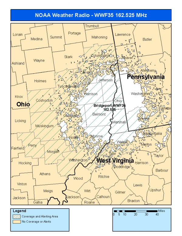
This radio station is licensed by the FCC to The National Weather Service for Bridgeport, OH and serving the following areas:


Belmont County, OH Carroll County, OH Columbiana County, OH Coshocton County, OH Guernsey County, OH Harrison County, OH Jefferson County, OH Monroe County, OH Morgan County, OH Muskingum County, OH Noble County, OH Perry County, OH Tuscarawas County, OH Washington County, OH Greene County, PA Brooke County, WV Hancock County, WV Marshall County, WV Ohio County, WV Pleasants County, WV Tyler County, WV Wetzel County, WV

We are not aware of any currently available online broadcast streams for this station.
Antenna Location: LAT: 40.0613223 ~ LON: -80.7526016
Loading Main Map for ...
NOAA Weather Radio WWF35 S.A.M.E. Code(s):
S.A.M.E.CountyState
039013BelmontOH
039019CarrollOH
039029ColumbianaOH
039031CoshoctonOH
039059GuernseyOH
039067HarrisonOH
039081JeffersonOH
039111MonroeOH
039115MorganOH
039119MuskingumOH
039121NobleOH
039127PerryOH
039157TuscarawasOH
039167WashingtonOH
042059GreenePA
054009BrookeWV
054029HancockWV
054051MarshallWV
054069OhioWV
054073PleasantsWV
054095TylerWV
054103WetzelWV
WWF35 Coverage Map
Service Frequency Power Latitide Longitude
NOAA Weather RadioWeather162.525 MHz1000 Watts40.0613223-80.7526016

[ Top of Page ]

"WWF35 (162.525) Bridgeport, OH - NOAA Weather Radio"

Radio Station:

Email: support@ | facebook | twitter
Policies: Terms & Conditions (EULA) | Privacy Policy | Cookies | DMCA

Copyright © 2025 Radio Station Network (RSN)

Station Image
Status
0:00
10
7
5
31Hz
62Hz
125kHz
250kHz
500kHz
1kHz
2kHz
4kHz
8kHz
15kHz
VOL.