NOAA Weather Radio Station

WXL83 162.400 Minot, ND

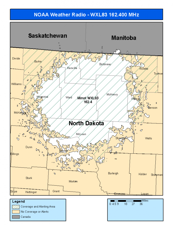
This radio station is licensed by the FCC to The National Weather Service for Minot, ND and serving the following areas:


Bottineau County, ND Burke County, ND McHenry County, ND McLean County, ND Mountrail County, ND Pierce County, ND Renville County, ND Rolette County, ND Ward County, ND

We are not aware of any currently available online broadcast streams for this station.
Antenna Location: LAT: 48.0505962 ~ LON: -101.3907194
Loading Main Map for ...
NOAA Weather Radio WXL83 S.A.M.E. Code(s):
S.A.M.E.CountyState
038009BottineauND
038013BurkeND
038049McHenryND
038055McLeanND
038061MountrailND
038069PierceND
038075RenvilleND
038079RoletteND
038101WardND
WXL83 Coverage Map
Service Frequency Power Latitide Longitude
NOAA Weather RadioWeather162.400 MHz1000 Watts48.0505962-101.3907194

[ Top of Page ]

"WXL83 (162.400) Minot, ND - NOAA Weather Radio"

Radio Station:

Email: support@ | facebook | twitter
Policies: Terms & Conditions (EULA) | Privacy Policy | Cookies | DMCA

Copyright © 2025 Radio Station Network (RSN)

Station Image
Status
0:00
10
7
5
31Hz
62Hz
125kHz
250kHz
500kHz
1kHz
2kHz
4kHz
8kHz
15kHz
VOL.