NOAA Weather Radio Station

WXL75 162.475 Holdrege, NE

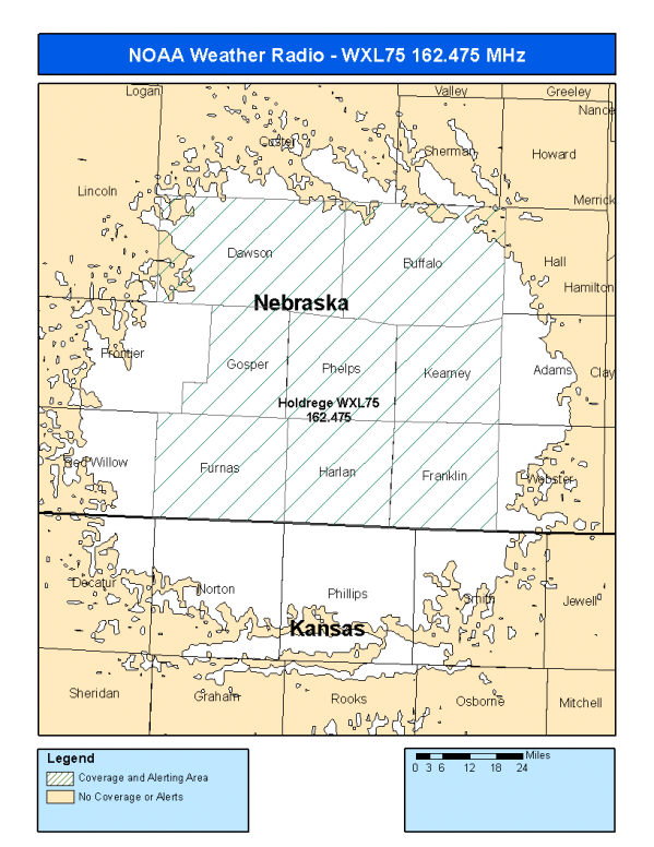
This radio station is licensed by the FCC to The National Weather Service for Holdrege, NE and serving the following areas:


Buffalo County, NE Dawson County, NE Franklin County, NE Furnas County, NE Gosper County, NE Harlan County, NE Kearney County, NE Phelps County, NE

We are not aware of any currently available online broadcast streams for this station.
Antenna Location: LAT: 40.3847930 ~ LON: -99.4586062
Loading Main Map for ...
NOAA Weather Radio WXL75 S.A.M.E. Code(s):
S.A.M.E.CountyState
031019BuffaloNE
031047DawsonNE
031061FranklinNE
031065FurnasNE
031073GosperNE
031083HarlanNE
031099KearneyNE
031137PhelpsNE
WXL75 Coverage Map
Service Frequency Power Latitide Longitude
NOAA Weather RadioWeather162.475 MHz1000 Watts40.3847930-99.4586062

[ Top of Page ]

"WXL75 (162.475) Holdrege, NE - NOAA Weather Radio"

Radio Station:

Email: support@ | facebook | twitter
Policies: Terms & Conditions (EULA) | Privacy Policy | Cookies | DMCA

Copyright © 2025 Radio Station Network (RSN)

Station Image
Status
0:00
10
7
5
31Hz
62Hz
125kHz
250kHz
500kHz
1kHz
2kHz
4kHz
8kHz
15kHz
VOL.