NOAA Weather Radio Station

KWN41 162.500 Shubert, NE

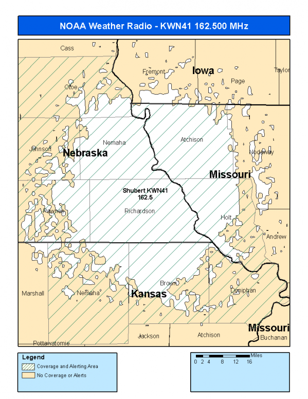
This radio station is licensed by the FCC to The National Weather Service for Shubert, NE and serving the following areas:


Brown County, KS Doniphan County, KS Nemaha County, KS Atchison County, MO Holt County, MO Johnson County, NE Nemaha County, NE Otoe County, NE Pawnee County, NE Richardson County, NE

We are not aware of any currently available online broadcast streams for this station.
Antenna Location: LAT: 40.2197322 ~ LON: -95.6657749
Loading Main Map for ...
NOAA Weather Radio KWN41 S.A.M.E. Code(s):
S.A.M.E.CountyState
020013BrownKS
020043DoniphanKS
020131NemahaKS
029005AtchisonMO
029087HoltMO
031097JohnsonNE
031127NemahaNE
031131OtoeNE
031133PawneeNE
031147RichardsonNE
KWN41 Coverage Map
Service Frequency Power Latitide Longitude
NOAA Weather RadioWeather162.500 MHz1000 Watts40.2197322-95.6657749

[ Top of Page ]

"KWN41 (162.500) Shubert, NE - NOAA Weather Radio"

Radio Station:

Email: support@ | facebook | twitter
Policies: Terms & Conditions (EULA) | Privacy Policy | Cookies | DMCA

Copyright © 2025 Radio Station Network (RSN)

Station Image
Status
0:00
10
7
5
31Hz
62Hz
125kHz
250kHz
500kHz
1kHz
2kHz
4kHz
8kHz
15kHz
VOL.