NOAA Weather Radio Station

WXL46 162.400 Springfield, MO

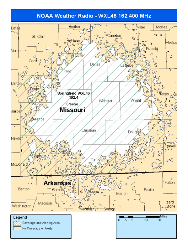
This radio station is licensed by the FCC to The National Weather Service for Springfield, MO and serving the following areas:


Barry County, MO Christian County, MO Dade County, MO Dallas County, MO Douglas County, MO Greene County, MO Laclede County, MO Lawrence County, MO Polk County, MO Stone County, MO Taney County, MO Webster County, MO Wright County, MO

We are not aware of any currently available online broadcast streams for this station.
Antenna Location: LAT: 37.1697299 ~ LON: -92.9417020
Loading Main Map for ...
NOAA Weather Radio WXL46 S.A.M.E. Code(s):
S.A.M.E.CountyState
029009BarryMO
029043ChristianMO
029057DadeMO
029059DallasMO
029067DouglasMO
029077GreeneMO
029105LacledeMO
029109LawrenceMO
029167PolkMO
029209StoneMO
029213TaneyMO
029225WebsterMO
029229WrightMO
WXL46 Coverage Map
Service Frequency Power Latitide Longitude
NOAA Weather RadioWeather162.400 MHz1000 Watts37.1697299-92.9417020

[ Top of Page ]

"WXL46 (162.400) Springfield, MO - NOAA Weather Radio"

Radio Station:

Email: support@ | facebook | twitter
Policies: Terms & Conditions (EULA) | Privacy Policy | Cookies | DMCA

Copyright © 2025 Radio Station Network (RSN)

Station Image
Status
0:00
10
7
5
31Hz
62Hz
125kHz
250kHz
500kHz
1kHz
2kHz
4kHz
8kHz
15kHz
VOL.