NOAA Weather Radio Station

KDO89 162.550 St. Louis, MO

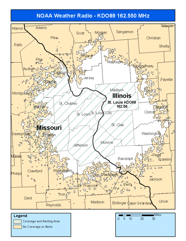
This radio station is licensed by the FCC to The National Weather Service for St. Louis, MO and serving the following areas:


Madison County, IL Monroe County, IL St. Clair County, IL Franklin County, MO Jefferson County, MO Lincoln County, MO St. Charles County, MO St. Louis County, MO St. Louis City, MO Warren County, MO


KDO89 can be heard online using the Radio Station Net Player.
Stream Status
Verifying KDO89 Audio Stream ...
Antenna Location: LAT: 38.5805426 ~ LON: -90.3292358
Loading Main Map for ...
NOAA Weather Radio KDO89 S.A.M.E. Code(s):
S.A.M.E.CountyState
017119MadisonIL
017133MonroeIL
017163St. ClairIL
029071FranklinMO
029099JeffersonMO
029113LincolnMO
029183St. CharlesMO
029189St. LouisMO
029510St. Louis CityMO
029219WarrenMO
KDO89 Coverage Map
Service Frequency Power Latitide Longitude
NOAA Weather RadioWeather162.550 MHz1000 Watts38.5805426-90.3292358

[ Top of Page ]

"KDO89 (162.550) St. Louis, MO - NOAA Weather Radio"

Radio Station:

Email: support@ | facebook | twitter
Copyright © 2025 Radio Station Info All Rights Reserved.
Station Image
Status
0:00
10
7
5
31Hz
62Hz
125kHz
250kHz
500kHz
1kHz
2kHz
4kHz
8kHz
15kHz
VOL.