NOAA Weather Radio Station

WNG640 162.425 Leakesville, MS

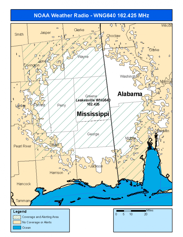
This radio station is licensed by the FCC to The National Weather Service for Leakesville, MS and serving the following areas:


Mobile County, AL Forrest County, MS George County, MS Greene County, MS Jones County, MS Perry County, MS Stone County, MS Wayne County, MS

We are not aware of any currently available online broadcast streams for this station.
Antenna Location: LAT: 31.1767061 ~ LON: -88.5976982
Loading Main Map for ...
NOAA Weather Radio WNG640 S.A.M.E. Code(s):
S.A.M.E.CountyState
001097MobileAL
028035ForrestMS
028039GeorgeMS
028041GreeneMS
028067JonesMS
028111PerryMS
028131StoneMS
028153WayneMS
WNG640 Coverage Map
Service Frequency Power Latitide Longitude
NOAA Weather RadioWeather162.425 MHz1000 Watts31.1767061-88.5976982

[ Top of Page ]

"WNG640 (162.425) Leakesville, MS - NOAA Weather Radio"

Radio Station:

Email: support@ | facebook | twitter
Copyright © 2025 Radio Station Info All Rights Reserved.
Station Image
Status
0:00
10
7
5
31Hz
62Hz
125kHz
250kHz
500kHz
1kHz
2kHz
4kHz
8kHz
15kHz
VOL.