NOAA Weather Radio Station

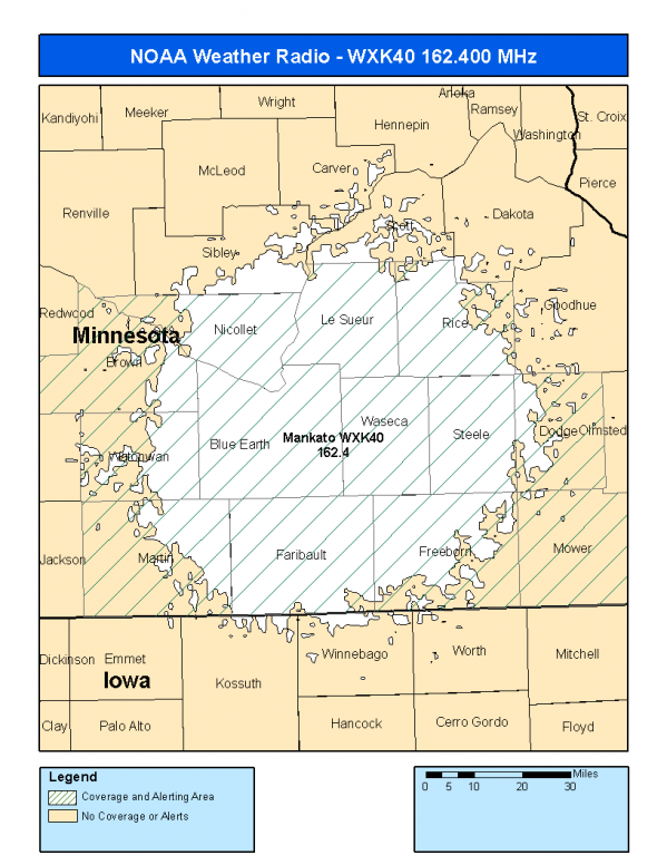
WXK40 162.400 Mankato, MN

This radio station is licensed by the FCC to The National Weather Service for Mankato, MN and serving the following areas:


Blue Earth County, MN Brown County, MN Dodge County, MN Faribault County, MN Freeborn County, MN Le Sueur County, MN Martin County, MN Mower County, MN Nicollet County, MN Rice County, MN Steele County, MN Waseca County, MN Watonwan County, MN

We are not aware of any currently available online broadcast streams for this station.
Antenna Location: LAT: 44.0877700 ~ LON: -93.7017059
Loading Main Map for ...
NOAA Weather Radio WXK40 S.A.M.E. Code(s):
S.A.M.E.CountyState
027013Blue EarthMN
027015BrownMN
027039DodgeMN
027043FaribaultMN
027047FreebornMN
027079Le SueurMN
027091MartinMN
027099MowerMN
027103NicolletMN
027131RiceMN
027147SteeleMN
027161WasecaMN
027165WatonwanMN
WXK40 Coverage Map
Service Frequency Power Latitide Longitude
NOAA Weather RadioWeather162.400 MHz1000 Watts44.0877700-93.7017059

[ Top of Page ]

"WXK40 (162.400) Mankato, MN - NOAA Weather Radio"

Radio Station:

Email: support@ | facebook | twitter
Policies: Terms & Conditions (EULA) | Privacy Policy | Cookies | DMCA

Copyright © 2025 Radio Station Network (RSN)

Station Image
Status
0:00
10
7
5
31Hz
62Hz
125kHz
250kHz
500kHz
1kHz
2kHz
4kHz
8kHz
15kHz
VOL.