NOAA Weather Radio Station

WNG676 162.500 Clearwater, MN

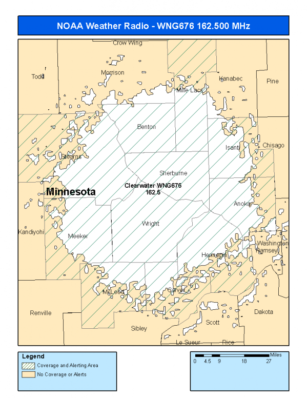
This radio station is licensed by the FCC to The National Weather Service for Clearwater, MN and serving the following areas:


Anoka County, MN Benton County, MN Carver County, MN Hennepin County, MN Isanti County, MN McLeod County, MN Meeker County, MN Mille Lacs County, MN Sherburne County, MN Stearns County, MN Wright County, MN

We are not aware of any currently available online broadcast streams for this station.
Antenna Location: LAT: 45.3483941 ~ LON: -93.9089870
Loading Main Map for ...
NOAA Weather Radio WNG676 S.A.M.E. Code(s):
S.A.M.E.CountyState
027003AnokaMN
027009BentonMN
027019CarverMN
027053HennepinMN
027059IsantiMN
027085McLeodMN
027093MeekerMN
027095Mille LacsMN
027141SherburneMN
027145StearnsMN
027171WrightMN
WNG676 Coverage Map
Service Frequency Power Latitide Longitude
NOAA Weather RadioWeather162.500 MHz1000 Watts45.3483941-93.9089870

[ Top of Page ]

"WNG676 (162.500) Clearwater, MN - NOAA Weather Radio"

Radio Station:

Email: support@ | facebook | twitter
Policies: Terms & Conditions (EULA) | Privacy Policy | Cookies | DMCA

Copyright © 2025 Radio Station Network (RSN)

Station Image
Status
0:00
10
7
5
31Hz
62Hz
125kHz
250kHz
500kHz
1kHz
2kHz
4kHz
8kHz
15kHz
VOL.