NOAA Weather Radio Station

WWG71 162.425 Morehead, KY

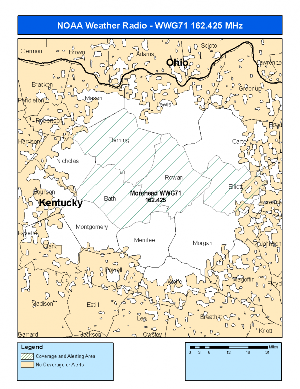
This radio station is licensed by the FCC to The National Weather Service for Morehead, KY and serving the following areas:


Bath County, KY Elliott County, KY Fleming County, KY Rowan County, KY

We are not aware of any currently available online broadcast streams for this station.
Antenna Location: LAT: 38.1774136 ~ LON: -83.4047484
Loading Main Map for ...
NOAA Weather Radio WWG71 S.A.M.E. Code(s):
S.A.M.E.CountyState
021011BathKY
021063ElliottKY
021069FlemingKY
021205RowanKY
WWG71 Coverage Map
Service Frequency Power Latitide Longitude
NOAA Weather RadioWeather162.425 MHz500 Watts38.1774136-83.4047484

[ Top of Page ]

"WWG71 (162.425) Morehead, KY - NOAA Weather Radio"

Radio Station:

Email: support@ | facebook | twitter
Policies: Terms & Conditions (EULA) | Privacy Policy | Cookies | DMCA

Copyright © 2025 Radio Station Network (RSN)

Station Image
Status
0:00
10
7
5
31Hz
62Hz
125kHz
250kHz
500kHz
1kHz
2kHz
4kHz
8kHz
15kHz
VOL.