NOAA Weather Radio Station

WXL94 162.550 Waterloo, IA

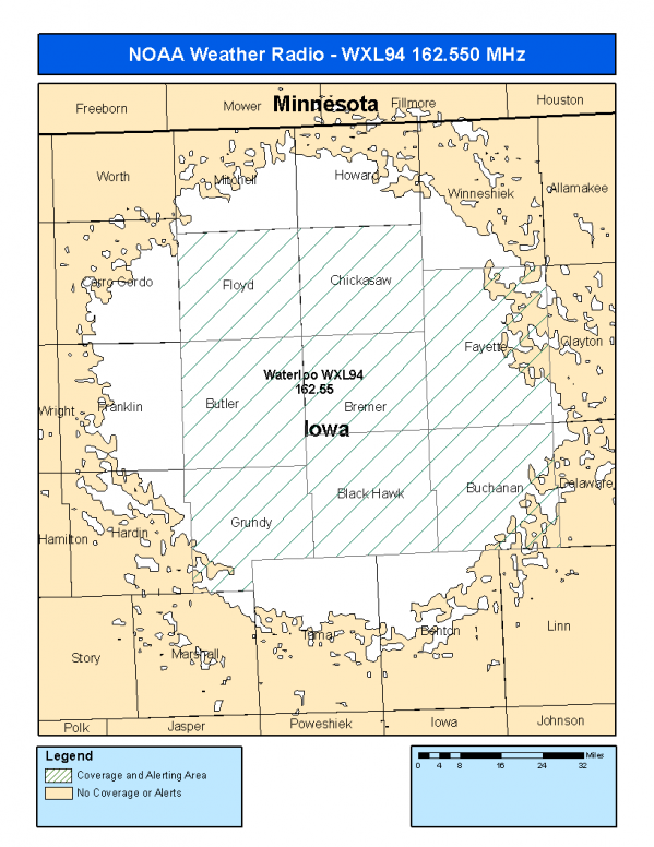
This radio station is licensed by the FCC to The National Weather Service for Waterloo, IA and serving the following areas:


Black Hawk County, IA Bremer County, IA Buchanan County, IA Butler County, IA Chickasaw County, IA Fayette County, IA Floyd County, IA Grundy County, IA


WXL94 can be heard online using the Radio Station Net Player.
Stream Status
Verifying WXL94 Audio Stream ...
Antenna Location: LAT: 42.7724791 ~ LON: -92.3767805
Loading Main Map for ...
NOAA Weather Radio WXL94 S.A.M.E. Code(s):
S.A.M.E.CountyState
019013Black HawkIA
019017BremerIA
019019BuchananIA
019023ButlerIA
019037ChickasawIA
019065FayetteIA
019067FloydIA
019075GrundyIA
WXL94 Coverage Map
Service Frequency Power Latitide Longitude
NOAA Weather RadioWeather162.550 MHz1000 Watts42.7724791-92.3767805

[ Top of Page ]

"WXL94 (162.550) Waterloo, IA - NOAA Weather Radio"

Radio Station:

Email: support@ | facebook | twitter
Policies: Terms & Conditions (EULA) | Privacy Policy | Cookies | DMCA

Copyright © 2025 Radio Station Network (RSN)

Station Image
Status
0:00
10
7
5
31Hz
62Hz
125kHz
250kHz
500kHz
1kHz
2kHz
4kHz
8kHz
15kHz
VOL.