NOAA Weather Radio Station

WWG99 162.500 Bonners Ferry, ID

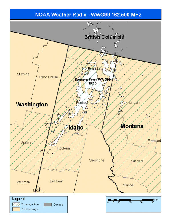
This radio station is licensed by the FCC to The National Weather Service for Bonners Ferry, ID and serving the following areas:


Bonner County, ID Boundary County, ID Kootenai County, ID Lincoln County, MT Sanders County, MT Spokane County, WA

We are not aware of any currently available online broadcast streams for this station.
Antenna Location: LAT: 48.6103984 ~ LON: -116.2577212
Loading Main Map for ...
NOAA Weather Radio WWG99 S.A.M.E. Code(s):
S.A.M.E.CountyState
016017BonnerID
016021BoundaryID
016055KootenaiID
030053LincolnMT
030089SandersMT
053063SpokaneWA
WWG99 Coverage Map
Service Frequency Power Latitide Longitude
NOAA Weather RadioWeather162.500 MHz100 Watts48.6103984-116.2577212

[ Top of Page ]

"WWG99 (162.500) Bonners Ferry, ID - NOAA Weather Radio"

Radio Station:

Email: support@ | facebook | twitter
Policies: Terms & Conditions (EULA) | Privacy Policy | Cookies | DMCA

Copyright © 2025 Radio Station Network (RSN)

Station Image
Status
0:00
10
7
5
31Hz
62Hz
125kHz
250kHz
500kHz
1kHz
2kHz
4kHz
8kHz
15kHz
VOL.