NOAA Weather Radio Station

WWH33 162.500 Cornwall, CT

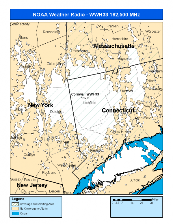
This radio station is licensed by the FCC to The National Weather Service for Cornwall, CT and serving the following areas:


Fairfield County, CT Hartford County, CT Litchfield County, CT New Haven County, CT Berkshire County, MA Hampden County, MA Dutchess County, NY Putnam County, NY


WWH33 can be heard online using the Radio Station Net Player.
Stream Status
Verifying WWH33 Audio Stream ...
Antenna Location: LAT: 41.8212387 ~ LON: -73.2972568
Loading Main Map for ...
NOAA Weather Radio WWH33 S.A.M.E. Code(s):
S.A.M.E.CountyState
009001FairfieldCT
009003HartfordCT
009005LitchfieldCT
009009New HavenCT
025003BerkshireMA
025013HampdenMA
036027DutchessNY
036079PutnamNY
WWH33 Coverage Map
Service Frequency Power Latitide Longitude
NOAA Weather RadioWeather162.500 MHz500 Watts41.8212387-73.2972568

[ Top of Page ]

"WWH33 (162.500) Cornwall, CT - NOAA Weather Radio"

Radio Station:

Email: support@ | facebook | twitter
Policies: Terms & Conditions (EULA) | Privacy Policy | Cookies | DMCA

Copyright © 2025 Radio Station Network (RSN)

Station Image
Status
0:00
10
7
5
31Hz
62Hz
125kHz
250kHz
500kHz
1kHz
2kHz
4kHz
8kHz
15kHz
VOL.